
Camp Somerset for Girls
All girls
Overnight camp
7 - 14 yrs
About our camp
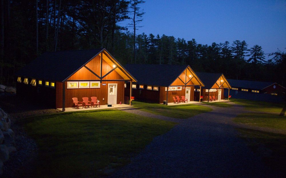
There is no greater responsibility than caring for someone else's daughter and our campers' health and safety are our ultimate priorities. It’s also critical to us that they return home with an increased sense of self-worth and fulfillment that comes from the experiences and relationships that summer camp provides. Our goal is simple: to empower, encourage, and inspire. Camp Somerset for Girls was founded in 2018 and boasts a spectacular brand new facility along East Pong in central Maine. Session lengths include two weeks, three and a half weeks and seven weeks. To “eliminate distraction and unhealthy competition”, camp Somerset is a uniform "light" camp, meaning that campers may wear what they wish from a limited selection of clothing, but do not need to match. Facilities include a state of the art lakefront dining hall, a dance/gymnastics/fitness pavilion, arts & crafts barn, culinary center, an outdoor meeting pavilion, basketball/hockey/tennis courts, three massive sports fields, a swimming pool, and a quiet cove on East Pond, ideal for swimming, sailing, kayaking, waterskiing and more. One of a kind camper cabins include full bathroom facilities and sleep 10 campers and three counselors. Owners and directors Kate Auerbach (a former attorney) and Josh Hahn (a former restaurateur) grew up together and are lifelong friends with more than 25 years of camping experience.
Activities
35+ activities to choose from - here are some highlights:
 Archery
 Bowling
 Cooking
 Drawing
 Gymnastics
 Painting
Session overview
- Camp season
- 25 Jun - 11 Aug 2026
- Program profile
- 3 sessions · Overnight
- Rates & Stays Planning Estimate
- Day sessionPer-day tuitionN/AOvernight sessionPer-night tuitionfrom $364 USD
Program-specific tuition options
This camp may offer session-specific tuition structures, including variations by length of stay, enrollment timing, or payment schedule. Families should confirm details directly with the provider.
Per-night (overnight) and per-day (day) figures are calculated from each session's standard tuition and shown as a planning reference only. We show the lowest per-night or per-day rate across this camp's sessions, so the total for a given session, and your actual tuition, may be higher depending on length of stay, age group, or enrollment timing.
This estimate helps families understand the overall scale of commitment across stay options. Final tuition, inclusions, discounts, and payment structures vary by session and are confirmed directly with the camp.
Upcoming sessions:
Where our camp is located
Smithfield, Maine, United States
Field Guide
Summer camp in Maine
A field guide to what a camp summer looks like in Maine: the forms it takes, how the landscape and climate shape it, and what it asks of a family.
Disclaimer & Safety
General information:
This content is for informational purposes only and reflects market observations and publicly available sources. Kampspire is an independent platform and does not provide medical, legal, psychological, safety, travel, or professional advisory services.
Safety & oversight:
Camp programs operate within local health, safety, and child-care frameworks that vary by region. Because these standards are set and enforced locally, families should consult the camp directly and relevant local authorities for the most current information on safety practices and supervision.
Our role:
Kampspire does not verify, monitor, or evaluate compliance with these standards. Program details, pricing, policies, and availability are determined by individual providers and must be confirmed directly with them.