
KenMont Camp
All boys
Overnight camp
7 - 15 yrs
About our camp
At Camp KenMont, physical, social and emotional growth of campers are a top priority. Everyone connects, shares and accepts challenges to build independence and life skills. The experienced staff at KenMont knows the importance of providing both competitive and non-competitive options to campers. Those who love to compete are welcome to take part in tournaments and intramural sports leagues. If a camper wishes to simply develop skills and practice, vast choices in various categories are available. In any case, at the heart of every activity lie sportsmanship, fair play, skill development and personal growth. Campers live in modern cabins with bathrooms and showers. Staff and campers come together in the spacious and air-conditioned dining hall to have their daily meals and to socialize. KenMont states that boys are “not only safe but focused on, listened to and appreciated”. Caring staff members, who love working with children and help them develop essential life skills, are also role models.
Our programs
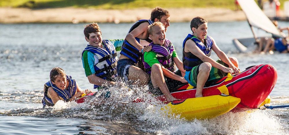
Facilities promise a full, exciting camp experience: 3 soccer fields, 3 hockey rinks, 7 basketball and 20 tennis courts, gymnasium, baseball and softball fields, a climbing wall, zip line, archery ranges, a theatre, studios to try ceramics and jewelry, a radio station, media arts lab, and more. Boys will also have fun and acquire new skills while participating in waterfront activities: swimming, water skiing, canoeing, sailing, paddleboarding, kneeboarding, and wakeboarding.
Activities
33+ activities to choose from - here are some highlights:
 Archery
 Baseball
 Basketball
 Canoeing
 Hockey
 Jewelry making
Session overview
- Camp season
- 25 Jun - 16 Aug 2026
- Program profile
- 4 sessions · Overnight
- Rates & Stays Planning Estimate
- Day sessionPer-day tuitionN/AOvernight sessionPer-night tuitionfrom $400 USD
Program-specific tuition options
This camp may offer session-specific tuition structures, including variations by length of stay, enrollment timing, or payment schedule. Families should confirm details directly with the provider.
Per-night (overnight) and per-day (day) figures are calculated from each session's standard tuition and shown as a planning reference only. We show the lowest per-night or per-day rate across this camp's sessions, so the total for a given session, and your actual tuition, may be higher depending on length of stay, age group, or enrollment timing.
This estimate helps families understand the overall scale of commitment across stay options. Final tuition, inclusions, discounts, and payment structures vary by session and are confirmed directly with the camp.
Upcoming sessions:
Where our camp is located
Kent, Connecticut, United States
Field Guide
Summer camp in Connecticut
A field guide to what a camp summer looks like in Connecticut: the forms it takes, how the landscape and climate shape it, and what it asks of a family.
Disclaimer & Safety
General information:
This content is for informational purposes only and reflects market observations and publicly available sources. Kampspire is an independent platform and does not provide medical, legal, psychological, safety, travel, or professional advisory services.
Safety & oversight:
Camp programs operate within local health, safety, and child-care frameworks that vary by region. Because these standards are set and enforced locally, families should consult the camp directly and relevant local authorities for the most current information on safety practices and supervision.
Our role:
Kampspire does not verify, monitor, or evaluate compliance with these standards. Program details, pricing, policies, and availability are determined by individual providers and must be confirmed directly with them.