
Lake of the Woods
All girls
Overnight camp
7 - 15 yrs
About our camp
Lake of the Woods for Girls is the sister camp of Greenwoods Camp for Boys. Its 2-week program is open to 6-15-year-old girls, while those who are 7-15 years old, can participate in 4 or 8-week sessions. On the challenging path of developing independence, girls are not left alone. They create their own schedules - having their parents’ valuable input. Surely, coaches, counselors and directors are also available at every moment to provide guidance, assist in making a decision or help in finding a passion to pursue. In short, girls learn and practice “being their best self”. Professionally trained staff takes care of girls, ensuring not only their physical safety but also emotional well-being. The staff does its best to cultivate competence, citizenship, resilience and optimism, so that the campers are well-equipped for the demanding environment of the 21st century.
Our programs
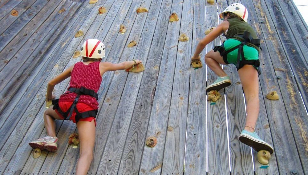
A wide range of facilities attract campers from all corners of the world – heated swimming pool, Equestrian center, a climbing wall, as well as fitness, culinary and recording studios. On top of this, the beautiful lake frontage enables everyone to enjoy activities such as: windsurfing, canoeing, lifesaving, kneeboarding, tubing, etc. Trips, special events and an entertaining evening program are also in place “to create those once-in-a-lifetime stories”.
Activities
59+ activities to choose from - here are some highlights:
 Archery
 Campfires
 Canoeing
 Cooking
 Drawing
 Free play
Session overview
- Camp season
- N/A
- Program profile
- 0 sessions · N/A
- Rates & Stays Planning Estimate
- Day sessionPer-day tuitionN/AOvernight sessionPer-night tuitionN/A
Program-specific tuition options
This camp may offer session-specific tuition structures, including variations by length of stay, enrollment timing, or payment schedule. Families should confirm details directly with the provider.
Per-night (overnight) and per-day (day) figures are calculated from each session's standard tuition and shown as a planning reference only. We show the lowest per-night or per-day rate across this camp's sessions, so the total for a given session, and your actual tuition, may be higher depending on length of stay, age group, or enrollment timing.
This estimate helps families understand the overall scale of commitment across stay options. Final tuition, inclusions, discounts, and payment structures vary by session and are confirmed directly with the camp.
Upcoming sessions:
Where our camp is located
Decatur, Michigan, United States
Field Guide
Summer camp in Michigan
A field guide to what a camp summer looks like in Michigan: the forms it takes, how the landscape and climate shape it, and what it asks of a family.
Disclaimer & Safety
General information:
This content is for informational purposes only and reflects market observations and publicly available sources. Kampspire is an independent platform and does not provide medical, legal, psychological, safety, travel, or professional advisory services.
Safety & oversight:
Camp programs operate within local health, safety, and child-care frameworks that vary by region. Because these standards are set and enforced locally, families should consult the camp directly and relevant local authorities for the most current information on safety practices and supervision.
Our role:
Kampspire does not verify, monitor, or evaluate compliance with these standards. Program details, pricing, policies, and availability are determined by individual providers and must be confirmed directly with them.