There is a particular kind of summer morning here. A towel still damp from yesterday goes back in the bag, the drive to the pond or the harbor is short enough that nobody has to leave early, and the child is home again by supper with lake water or salt still in their hair. In the smallest state, camp is rarely a place you send a child away to. It is a place they go and come back from, most days, before dark.
The exception is the week away in the western woods, and even that stays close enough that a visit is not a journey. What shapes camp here is not distance but water. Narragansett Bay reaches so far into the state that almost every camp sits within reach of it, and the Bay decides more about a summer than any schedule will.
The useful way to read camp here is by what it is built to do rather than by the town it sits in. A handful of shapes recur: the everyday day camp on a pond or town waterfront, the sailing program that could only exist because of the Bay, the science and naturalist camp that turns the coast and the woods into a classroom, and the overnight week in the western part of the state. The water is why some of those forms look the way they do, but it is form, not the map, that tells a parent what a given summer will ask.
The everyday camp is a day camp
For most families here, camp is a day camp, and the setting is fresh water. Towns, community organizations, and neighborhood branches run week-by-week programs on the shores of ponds and reservoirs, with a swimming waterfront, fields and courts, arts tables, and a bus that carries a city branch out to an outdoor site for the day. The week has a shape a working parent can plan around, with early hours before it and late hours after.
What this asks of a family is small and repeatable. There is no goodbye at a gate, no long drive, no season-long commitment. Your child leaves in the morning and is back by evening, and next week can look nothing like this one. In a state this size, that daily rhythm is what camp usually means.
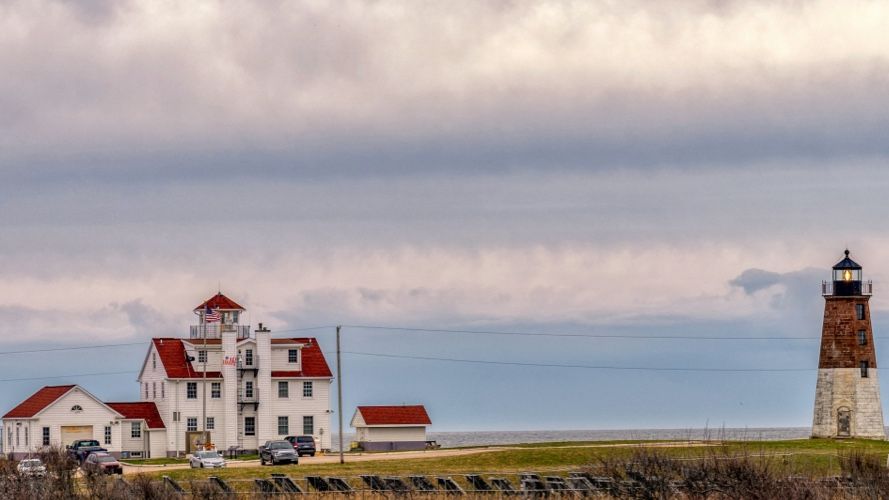
Out on the Bay, a boat at a time
Then there is the water itself. Public sailing centers, yacht-club youth programs, and community boating sites teach children to sail on the protected harbors of the Bay, from the youngest beginners in small dinghies up through racing. Newport carries a sailing culture known well beyond the state, and a child can step into it here without owning a boat.
A sailing week is not run by a schedule alone. It is run by wind and tide and the safety of the water on a given afternoon, and the day bends to conditions. Skills come in order and are earned rather than handed over, and sailing adapted for children with disabilities is part of the picture rather than an afterthought.
For a family, this is camp measured in competence. It comes with gear, with weather that can rearrange an afternoon, and often with a drive to reach the water. What a child brings home is not a craft project but the beginnings of knowing how to read a boat and a breeze.
The coast and the woods as a classroom
A whole strand of camp here treats the place as something to study. Along the shoreline and out on the Bay by boat, marine-science camps have children gathering and handling live animals, snorkeling calm water, and using real scientific tools. Inland and at the bayside refuges, naturalist camps walk children through fields, forests, ponds, and streams with educators who know them. The programs are banded by age, from the smallest children up to teenagers training to lead.
This is a curiosity-first summer, and it is usually close to home. It asks a family for interest more than for distance, and it rewards a child who would rather turn over a rock than win a game.
The week away, and how short away can be
The overnight camp does exist here, mostly in the wooded western and southern reaches. A long-standing tradition of troop camping runs on a large reservation of forest and pond, a few resident camps sit on lake and pond shores, and some overnight weeks are organized by faith communities or around a shared interest. Cabins and campsites, a swimming waterfront, campcraft, and the long arc of a week away all live here as they do anywhere.
It is a genuine strand, and it is a modest one. A state this small holds only so many resident camps, and a fair number of families cross the line into neighboring parts of southern New England for the overnight experience. That is worth knowing rather than glossing over.
This is the real departure in a Rhode Island summer, and yet the geography stays kind. The handoff is a short drive, a visit is rarely a long haul, and the goodbye at the start of the week is softened by how close home stays the whole time.
Summer here is warm and humid, the southern New England kind, with muggy inland afternoons and the odd thunderstorm rolling through. Near the water it eases: a sea breeze off the Bay can take the heat out of a hot day while inland sites stay heavier. The ocean and outer bay stay cool into early summer and swimming is bracing, while the shallower, protected water warms to comfortable as the season goes on. Mornings and the outer coast can fog in. In the woods and fields there are ticks and mosquitoes and poison ivy to know about, and late summer can carry the fringe of a coastal storm off the Atlantic. The season is short and clear, holding through the warm center of the year.
The parent's side of camp here is shaped by how little distance there is to cover. Day camps put you in daily contact by their very design, and even the overnight week sits close enough that a visit is not a journey. There is no camp-town hospitality economy to speak of. The coastal towns a parent passes through or lingers in near a camp are established destinations in their own right, so any waiting-around a family does overlaps ordinary coastal tourism rather than anything built for camp families. Contact norms differ from camp to camp and are worth settling directly with whoever runs the week.
What ties these together is proximity. Whatever shape camp takes here, it happens near water and near home, and it asks a family for less travel and less separation than the same choice would almost anywhere else. The trade is that the range runs narrower than a large state's, and the biggest overnight summers sometimes sit just across a state line. What matters is less how many forms there are than what each one actually asks of a child and a family.
If the forms here start to blur together, it helps to step back from Rhode Island and look at what kinds of camp exist at all. The camp archetypes lay out those underlying shapes, so that a sailing week and a naturalist week read as the different things they are. And when the question shifts from what camp is to how to think about choosing one, the guide for parents is the part of the Field Guide written for exactly that.