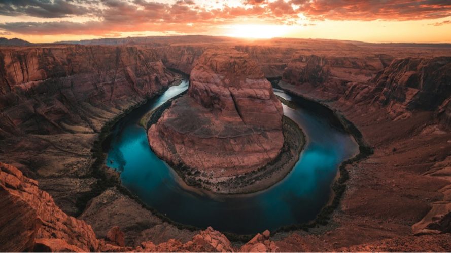
The summer camp system in Arizona.

A structural map of how geography, infrastructure, and routines shape camp life.

Arizona landscape

The Arizona camp system is defined by a vertical migration that bypasses extreme desert heat for the cooling effects of high-altitude forests. Infrastructure is centered on the management of solar radiation and the limited availability of mountain water sources. Operational stability depends on the rhythmic transition across the Mogollon Rim, where temperature and atmospheric pressure shift dramatically.

The primary logistical tension in Arizona is the management of rapid thermal oscillation and the physical load of high-altitude exertion against a landscape of extreme water scarcity.

The geography of summer.

Arizona regions.

The transition from low-desert basins to high-altitude plateaus creates a structural gate for every summer program.

In the southern and central regions, the Sonoran Desert presents a landscape of high-density thermal load where the sun serves as the primary environmental regulator. The terrain consists of alluvial fans and bajadas where the grit of decomposed granite surfaces as a constant tactile anchor. Transit in this region is compressed into early morning windows to avoid peak solar intensity. This environmental load on the low basins becomes visible through the strict avoidance of midday outdoor movement, which creates a rigid schedule of indoor programming during peak daylight hours.

Moving north, the elevation climbs abruptly into the Coconino and Kaibab National Forests where the geography is defined by volcanic peaks and deep canyons. The physical load in these highlands is shaped by thin air and rocky, high-friction trails that require significant cardiovascular output. A natural cooling canopy is provided by the world’s largest stand of ponderosa pines, yet the topography remains rugged and demanding. The sight of red-rock buttes and the scent of ponderosa bark define the visual and olfactory perimeter of these highland habitats.

Arizona geography utilizes a vertical escape model to ensure operational viability during the summer months. Programs move several thousand feet in elevation to bypass the valley heat, creating a significant temperature drop that dictates the hardware requirements for participants. In these high-desert zones, the physical boundary of a camp is frequently an arroyo. These dry washes serve as natural corridors but introduce structural risk during the North American Monsoon season. This terrain load surfaces as a constraint on campsite placement, where residential structures must be positioned outside of identified flow zones.

Sudden atmospheric shifts are signaled by the smell of wet dust and the echo of thunder. This environmental volatility introduces a system load on scheduling where outdoor activity must be paused the moment lightning detection hardware indicates a strike within a specific radius. The resulting schedule rigidity surfaces as a constraint on program continuity, requiring hardened shelters that can accommodate entire cohorts simultaneously. The transition from the desert floor to the high plateau represents a massive temperature shift which dictates the variety of apparel held in the packing list.

Transit friction is concentrated on the I-17 and Highway 87 corridors. These routes serve as the primary conduits for moving participants from the Phoenix metropolitan area into the mountain cooling zones. The physical weight of this movement becomes visible through heavy weekend traffic bottlenecks in mountain passes. High-country road density is low, meaning any disruption on these main arteries affects the arrival and departure rhythm for the entire system.

Wind through pine needles is constant.

Regional geography also includes the sky islands of the Chiricahua Mountains and the canyons of the Navajo Nation. Structural isolation is high in these areas due to the lack of paved surfaces and the vast distance from municipal hubs. The landscape of cliffs, cacti, and boulder fields serves as the primary physical barrier. High-visibility signage and established trail markers are necessary to prevent disorientation in the arid vastness. Soil profiles shift from sun-baked caliche in the valleys to volcanic cinders and forest duff in the highlands, affecting everything from drainage to tent-stake security.

Observed system features:

vertical migration across the Mogollon Rim.
early morning transit windows to manage thermal load.
arroyo boundary mapping for monsoon safety.

the smell of creosote after a monsoon rain.

The economics of camping.

Arizona infrastructure density.

The economic footprint of Arizona camps is tied to altitude and the physical capacity for water storage.

Civic Integration Hubs are densely packed within the Valley of the Sun and Tucson, utilizing high-thermal-mass buildings and high-output HVAC hardware. These hubs integrate with municipal water grids, which mitigates the cost of acquiring private water rights in an arid environment. The economic value of these programs is held in their proximity to existing community infrastructure. This reliance on the grid creates a system load on facility maintenance where cooling failure results in immediate suspension of operations.

Discovery Hubs are often embedded within the Arizona State University or University of Arizona ecosystems. These programs leverage specialized hardware like telescopes, mineral labs, and climate-controlled dormitories. The density of these hubs is concentrated in the state’s aerospace and technology corridors. The structural load here is primarily digital and technical, where high-speed data access is a baseline requirement for program delivery. This institutional integration surfaces as a constraint on participant movement, as cohorts must remain within the secure perimeters of the host campus.

Immersive Legacy Habitats occupy valuable forest acreage along the high-altitude Green Belt. Infrastructure in these areas must meet strict fire-safety codes, featuring metal roofs and cleared defensible spaces. The hum of a large-scale pressure tank is a constant artifact of these off-grid water systems. Land use patterns show a high concentration of camps on the edge of National Forest land, where the proximity to peaks provides a natural cooling infrastructure. This geography load surfaces as a constraint on total bed capacity, as fire evacuation routes can only support a specific volume of transit at one time.

Mastery Foundations utilize professional-grade hardware such as hydration bladders and UV-rated shelter fabrics. The density of staffing is highest during high-exertion activities to monitor for signs of altitude sickness. These programs are often located in the transition zone where the desert meets the mountains, providing access to diverse ecological hardware. The physical oversight of these environments is marked by significant investment in wildland-urban interface safety. Asset density is highest along the Rim where water availability and cooler temperatures create a natural center of gravity.

Infrastructure density is limited by water-table depth and the capacity of rural electric cooperatives to handle peak summer loads. The cost of cooling is a major operational line item for any program operating at low altitude. In mountain habitats, the investment shifts toward fire mitigation and forest management hardware. Operations include heavy use of industrial brush mowers to maintain safety perimeters. The sight of red slurry on trees from fire-retardant drops is a seasonal marker of the environmental pressure on these facilities.

Red roofs reflect the heat.

Resource rigidity becomes visible through the high cost of hauling water if primary wells fail or during periods of extreme drought. This load on the system surfaces as a constraint on kitchen output and sanitation protocols. The physical weight of water management is expressed through the presence of massive storage tanks that serve as the primary structural anchor of the campus. Each facility must balance its operational footprint against the recharge rate of its local aquifer.

Observed system features:

high-thermal-mass building density in desert basins.
off-grid water pressure tank maintenance.
wildland-urban interface fire-safety hardware.

the hum of a high-output HVAC unit.

Infrastructure and environment.

Visible oversight in Arizona.

Physical artifacts in the Arizona system are designed to manage the high-stakes reality of fire and water.

Hydration stations serve as the primary confidence anchors on any campus, appearing as large, insulated water barrels with gravity-fed taps. The use of UV-index flags and mandatory wide-brimmed hat policies are visible markers of oversight. These artifacts ensure that even in high-heat environments, the system maintains a constant check on participant readiness. This physiological load becomes visible through the mandatory water call ritual, which creates a rhythmic pause in all activities to ensure consistent fluid intake.

In the high forests, fire-risk levels are communicated through physical color-coded boards at camp entrances. These signs dictate the types of hardware, such as propane versus wood fire, permitted on site. Human ROI is observed in the correlation between strict shade-rotation protocols and the maintenance of energy levels throughout the daylight cycle. When shade is structurally prioritized, participants show fewer signs of heat-related fatigue in the late afternoon. This environmental oversight is expressed through the strategic placement of shade sails across all transition paths.

Weather oversight is particularly visible during the monsoon season when lightning detection hardware becomes the primary regulator of movement. The sound of a thunderclap or an automated alert from a weather station initiates an immediate transition to hardened shelters. This infrastructure-based approach to safety ensures that the physical risk of lightning is managed without relying solely on human observation. The presence of these systems provides a baseline of operational security. This system load on movement surfaces as a constraint on the duration of wilderness excursions.

In mountain habitats, oversight includes altitude anchors such as mandatory rest periods and high-calorie intake logs. These protocols manage the metabolic load of operating at high elevations. Transition friction is managed through the use of shaded breezeways and cool-down zones featuring misting hardware. The tactile experience of cold water on the neck provides a sensory guide for participants navigating the midday sun. Ramadas and shaded pavilions are the most critical structural assets in the Arizona system.

They provide a physical buffer against solar radiation and serve as the center of social and educational life. In Discovery Hubs, oversight is visible in the clean-room hardware and laboratory protocols that protect against dust and static electricity. These environments require constant filtration to maintain hardware integrity in the desert air. Physical oversight also includes hydration logs and color-coded wristbands that track water intake. The alignment of camp perimeters with forest firebreaks creates a landscape where safety is built into the land clearing itself.

Shadow stretches long under the ramada.

This load on the landscape surfaces as a constraint on how far a group can travel from established safety corridors. The resulting geographic rigidity is a necessary response to the speed of environmental shifts in the high desert. Oversight artifacts like lightning sirens and shade structures serve as the primary automated regulators of the summer environment. These systems ensure that the human footprint remains compatible with the uncompromising physics of the desert-mountain transition.

Observed system features:

insulated gravity-fed hydration stations.
lightning detection sirens and hardened shelters.
color-coded fire-risk entrance boards.

the clink of a metal canteen.

The Parent Side Quest.

The parallel experience that unfolds outside the camp system.

The parent-adjacent layer in Arizona is defined by a migration to the state’s mountain towns.

During camp sessions, towns like Sedona, Flagstaff, and Pinetop-Lakeside experience an influx of those occupying the parallel economy of red-rock hiking and high-altitude resorts. This waiting rhythm is characterized by a shift from the high-stress urban grid to the mountain time of the plateau. The sensory contrast is marked by the transition from desert dust to forest shade. This migration creates a system load on regional hospitality infrastructure, where room availability is stretched during camp turnover weekends.

Parents often occupy the cafes of Flagstaff’s Southside or the trailheads of Oak Creek Canyon. The rhythm is dictated by the availability of outdoor recreation and the seasonal temperature swing. This layer is not an operational extension but a parallel retreat that mirrors the camp’s own movement to higher ground. The physical distance between the desert home and the mountain camp necessitates multi-day stays in high-country lodges. This transit weight is expressed through the increased density of vehicles with roof racks and cooling equipment in mountain towns.

In the Verde Valley, the parent-adjacent experience may center on historic sites or vineyards. The smell of cedar and the sight of sweeping valleys provide a distinct backdrop for this waiting period. This geographic load becomes visible through the crowding of high-altitude scenic turnouts and river access points. The shift in population centers during the summer months places a seasonal strain on local services in small mountain communities. This surfaces as a constraint on dining availability and parking in historical districts like Jerome.

Prescott and Payson serve as primary gateways and logistical hubs for those entering the Arizona camp system. The sensory experience of this layer includes the constant sight of fire danger signs and the tactile feel of dry, thin air. Parents navigating this layer encounter the same monsoon cycle, which can lead to sudden shifts in plans due to road closures or flash flood warnings. The unpredictability of mountain weather dictates a flexible itinerary. The common experience is one of waiting in the shade of a different pine tree.

The creek runs cold over basalt.

In the south, the experience is often concentrated around Mount Lemmon where the cool air provides respite from the Tucson heat. This external layer operates on a timeline of sunrise to sunset, emphasizing the solar-driven nature of the Arizona summer. The parent-adjacent layer is a geographic mirror of the camp system, defined by the same search for altitude. This parallel retreat ensures that the familial rhythm remains synchronized with the environmental constraints of the state.

Observed system features:

high-country lodge occupancy during session starts.
mountain town cafe and trailhead density.
gateway town logistical support in Prescott and Payson.

the scent of mountain cedar.

Operational readiness.

Confidence anchors and transition friction.

Operational readiness in Arizona is anchored in thermal intelligence, where the schedule and hardware are aligned with the solar arc.

Confidence anchors, such as the early morning activity start and the midday siesta block, provide structural stability. These routines are designed to automate the daily rhythm, reducing the metabolic load on participants. The success of the system depends on the strict adherence to these time-based protocols. This environmental load surfaces as a constraint on spontaneous activity, as any deviation from the shade-management plan introduces physiological risk to the cohort.

The messy truth of an Arizona summer includes the presence of nosebleeds due to low humidity and the physical fatigue of altitude adjustment. Constant grit on every surface is a structural constant that the system is designed to absorb. Readiness is physically manifested in the volume of water storage and the integrity of shade-cloth hardware. If these physical assets are compromised, the operational safety of the program degrades rapidly. This resource rigidity becomes visible through the daily inspection of all hydration tap points and pressure gauges.

Acclimatization anchors are used to manage transition friction. These consist of mandatory slow-movement periods for the first day of a program to allow for cardiovascular adjustment to the altitude. The sound of a functional HVAC system or the visual of a full water tank provides a physical signal of operational security. These signals are essential for maintaining participant confidence in an environment that can feel physically taxing. The load of high-altitude exertion is expressed through the increased volume of rest periods in the initial program phase.

Readiness is also visible in a facility’s fire-mitigation state. The absence of tall grass near buildings and the presence of charged fire extinguishers at every cabin entrance are critical artifacts. Evacuation zones must be clearly marked and accessible. This readiness surfaces as a constraint on how equipment is stored and how vehicles are positioned, ensuring that the system is always prepared for a rapid departure if forest conditions shift. The presence of red fire-slurry on perimeter foliage serves as a constant reminder of this operational stance.

Operational stability is maintained through the strict physical regulation of body temperature. Shadow load in this system includes the buffer of extra electrolytes and high-SPF topical hardware required to prevent environmental breakdown. The alignment of human behavior with the physics of the desert-mountain transition is the ultimate measure of readiness. When the hydration system is intact and the shade rotation is disciplined, the system remains stable. The daily ritual of checking the wind speed and humidity levels provides the data necessary to adjust the day's physical load.

Dust settles on the porch at dusk.

Observed system features:

mandatory altitude acclimatization periods.
siesta blocks during peak thermal load.
fire-mitigation clearing and evacuation marking.

the taste of electrolyte-replacement water.

Kampspire Field Guide

A shared way to understand camp environments

The Field Guide sits in the space between research and arrival, helping you understand how camp environments work before you experience them.

Disclaimer & Safety

General information:

This content is for informational purposes only and reflects market observations and publicly available sources. Kampspire is an independent platform and does not provide medical, legal, psychological, safety, travel, or professional advisory services.

Safety & oversight:

Camp programs operate within local health, safety, and child-care frameworks that vary by region. Because these standards are set and enforced locally, families should consult the camp directly and relevant local authorities for the most current information on safety practices and supervision.

Our role:

Kampspire does not verify, monitor, or evaluate compliance with these standards. Program details, pricing, policies, and availability are determined by individual providers and must be confirmed directly with them.