There is a stretch of high summer when the valley floor holds its heat well past dark, and the only cool air within reach is up a canyon, somewhere past the last stoplight, where the road narrows and the pines lean in. A great deal of what summer means for children in Utah lives in that gap between the hot, bright basin where most families live and the high, cold country a short climb above it.
Camp here is not a single thing. It is a morning drop-off a short walk from home. It is a bunk at elevation with nights that turn cold in the middle of July. It is a raft on a desert river far to the south, and it is a tradition kept quietly inside a family's own community. Knowing which of these you are looking at, and what each one asks of you, is most of the work.
The honest way to sort camp in Utah is by what a program actually is and what it asks of a family, not by which stretch of scenery sits behind it. A beautiful canyon is not evidence that a camp waits inside it. A handful of shapes recur here: the day camp that fits inside a working week, the away camp that carries children into the backcountry, the camp kept within a congregation, and the land-based youth practice of Native communities in the southeast. Only in the away camp does terrain truly drive the difference, and there it drives it hard, so that a cool pine camp up the northern canyons and a hot expedition down in the red rock end up being the same word wrapped around opposite days.
The camp that fits inside a working week
For most families here, summer camp never leaves town. It runs out of a recreation center, a museum, a nature center, a university campus, or an arts and science studio, clustered thickly along the Wasatch Front where the population is. Children are dropped off in the morning and collected in the afternoon, and the day in between might be swimming and themed weeks and hikes, or it might be robotics, coding, film, theater, or a sport pursued in earnest.
The range is wide and easy to find, which makes this the ordinary shape of a Utah summer rather than the exceptional one. What it asks of a family is small in miles and steady in rhythm: a drop-off close to home, a pickup at day's end, and an information loop that closes the same afternoon. There is no handoff to somewhere far away, only the daily one.
Up the canyons, and down into the red rock
The away camp is where terrain takes over. Climb the canyon roads east of the valleys, or push higher into the Uinta country, and camp becomes cabins at elevation: canoeing on cold mountain water, alpine hikes, archery, mountain biking, and camp theater, with nights that turn genuinely cold even in the heat of the year. It is close enough that a parent can be an hour or so down the mountain and still feel near.
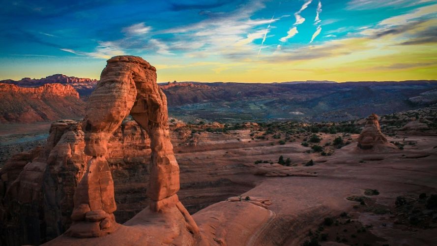
Drive the long way south instead, toward the red-rock country around the desert rivers, and the same idea becomes something almost opposite. Here camp means canyoneering, rappelling, climbing, and running a desert river, with the heat and the hydration that go with it. Some of it runs as day trips and some as multi-day expeditions, and some is set aside for families who already live in that far corner of the state, so it is worth asking what is genuinely open to you.
These settings share a single fact worth planning around: once a group is up a trail, deep in a canyon, or out on the water, contact closes for a while by design. The northern camps sit close to the hub and are easy to reach. The southern ones are remote, a long haul from the airport, and past the trailheads and river put-ins the road simply ends. What this form asks is a tolerance for distance and for quiet on the line, more in the south than the north.
Camp kept within a congregation
A large part of summer for children here runs through faith. Across the state, congregations hold their own youth camps in the mountains, among them a long-standing summer camp tradition for young women, carried out on camp properties at elevation. These weeks tend to be organized within a family's own community rather than shopped for from outside, and they serve that community's own young people.
Described plainly, this is less a program a family selects than a rhythm a family is already part of. The handoff, when it comes, is usually to leaders the family already knows, in a place the community returns to summer after summer. For a family outside a given congregation, it reads more as a cultural pattern of the place than as something to enrol in.
Older ground in the southeast
In the far southeast, in the canyon country and the Bears Ears landscape, summer for some children means time on ancestral land. Within these communities, land-based youth programming is widely understood as a way for young people to spend time on ground their families have long known, learning traditional practices, language, and stewardship, often with elders teaching alongside knowledge of the land itself.
Seen from outside, this is not a camp an unconnected family signs up for, and it would be wrong to describe it as one. It is community-held and tends to serve local Native youth on its own cadence. The respectful thing an outside guide can do is note that it exists, that it belongs to the communities who carry it, and leave the details to them.
Utah summer is dry heat and hard sun. Down in the valleys the days run hot and bright with very low humidity, and because the air holds so little water, the temperature drops sharply after dark, so the swing between afternoon and midnight is large. Elevation rewrites all of it, so a mountain camp can be warm at noon and cold enough for a jacket at night. Later in the season, afternoon storms build, heaviest in the south, and in slot canyons and dry washes they bring a real flash-flood hazard that shapes how a canyon day is run. Lakes and streams fed by snowmelt stay cold and bracing, so swimming is a quick, waking-up kind of thing rather than a lazy one. In a dry spell, wildfire smoke can drift through. Sun and water intake, not humidity, are the daily things to mind.
Because so much of camp here sits where families already live, the parent's summer is often a matter of morning drop-offs and afternoon pickups, with the loop closing the same day. The mountain resident camps stretch that only a little; the distance is a canyon drive, and word travels quickly. It is the southern canyon country that asks the most, with long drives, thin service, and stretches where contact genuinely closes until a group is back off the river. Near the desert parks there are towns where a waiting parent can stay, but that overlaps ordinary national-park travel more than any camp-parent economy, and it is fairer to call it that. Where camp runs through a congregation or a community, the family is usually already woven into the people running it, and the handoff is to someone known.
What ties these together is that gap between the hot valley and the cold height above it, and the fact that camp in Utah runs the whole distance from an open, easy market to something a family is simply born into. The task is rarely finding a camp. It is reading which kind you are actually looking at, and being honest about which ones welcome an outside family and which ones were never meant to.
If this is early days and the whole idea of handing a summer to a camp still feels large, the guide for parents is the part of the Field Guide that walks through how to think it through, wherever you are starting. And if you have noticed that the camps here seem to be chasing different things, some building skills, some building belonging, some carrying a tradition forward, that instinct has a language: the camp archetypes are a way to understand those underlying shapes, here and anywhere. In a place this varied, they map loosely more than neatly, which is itself worth knowing.